
DOMINATING Mount Defiance: The BEASTLIEST Hike in The Gorg
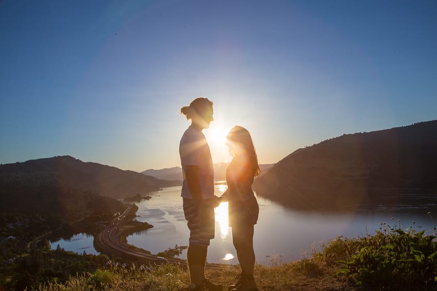
mosier plateau, sunset on the gorge oregon
Before we fill you in on hiking the beast that is Mt Defiance, let’s give you a quick update on #LifeAfterVan: It’s been a bit weird being apart after spending every waking and sleeping hour together, living in our 18-foot van home. And by being apart I mean we still live in the same house, share the same room and sleep in the same bed, but there’s something so… separate about leading such different daytime lives. We know that VanLife is an extreme, and yes, at times we needed our space, but it seems that “normal life,” is just as extreme, but in a different, less connected sort of way maybe? We wondered how we would adjust to it all, if we would miss it, and basically all we have to say is that we can’t wait to be back in the van again. If you haven’t seen our YouTube video on “How we lived VanLife in Croatia for 89 days,” you can catch it below. I’ve been putting my video editing skills to work in order to share all of our fave footage from VanLife Europe Part 1 before Part 2 begins!
Alright, on to the mountains we go! I decided to hike Mount Defiance when I learned that we wouldn’t be hiking Mt St Helen’s because of all the work Drew had to do for the upcoming event. I was bummed, of course I understood, but still, I was totally bummed. Keeping a positive attitude though, I decided to focus on how the setback would make summiting MSH next summer THAT much more rewarding! And, in order to prevent my adventure-craving soul from getting “hangry”, I decided to introduce myself to another mountain in the meantime… the granddaddy of the Gorge, Mount Defiance:
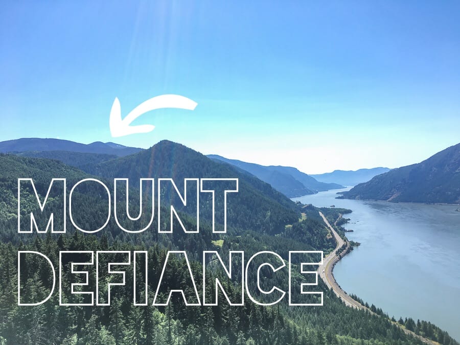
Mt Defiance, best hikes in oregon
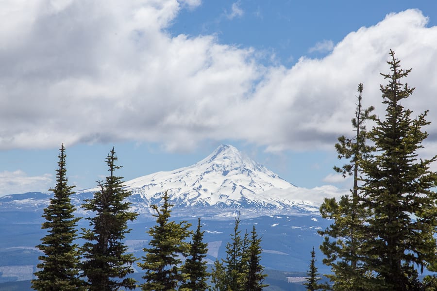
The photo above is just a glimpse of the mighty 4,960 foot summit of Mt D, the highest point on the Columbia River Gorge, as seen from the summit of another nearby hike, Mitchell Point. With the Mount Defiance trailhead being a mere 20-minute drive from our place in Hood River, this manageable, yet INTENSE, day hike, with reportedly well-maintained trails, great views and an unmistakable sense of accomplishment at the end, had me hooked. Just to give you an idea of the CRAZY ELEVATION of Mt D, here’s a topographical map of the area – the red line leads to the top of the summit, and the actual hike starts at the very bottom, next to the highway:
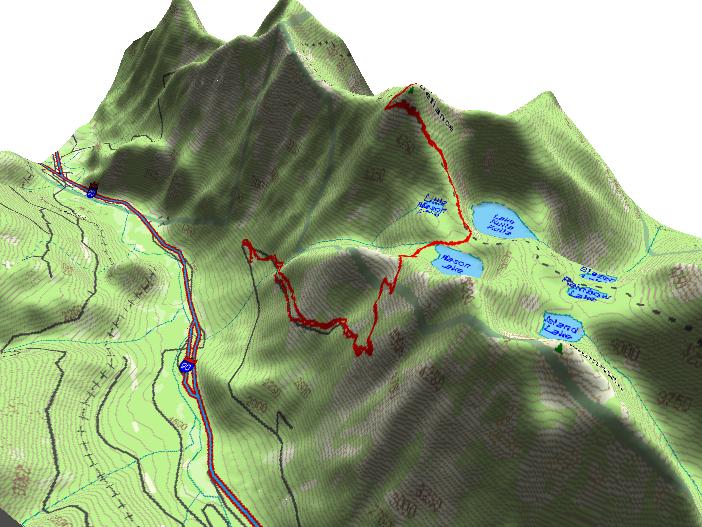
mount defiance elevation, trail map mount defiance
So what is THE BEST way to hike this beast? After reading a ton of comments and reviews I decided to tackle this hike in the OPPOSITE direction than most (popular route here), which honestly was a BRILLIANT idea. While everyone else was dealing with crowds, I was enjoying the sweet sound of solitude + tons of happy little birds, and I was free to go entirely at my own pace. On my way up I passed just 2 people who were descending, and on my way down, I met just 1 group who was still making their way up. That was it! Now, hiking Mt D the “opposite way” did mean that I had a longer and steeper ascent (1,000 feet per mile steep!), but it also meant that I had a more gradual and shorter descent, and while I worked my muscles more on the way up, I also pounded on my knees and joints less on the way down, which is my kind of a recipe.
mt defiance hike, starvation ridge trail, oregon hikes
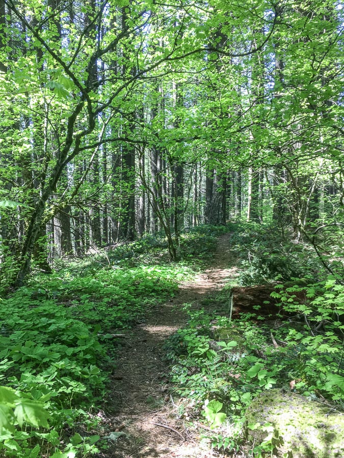
Directions: After parking at Starvation Creek Trailhead, start by going up the Starvation Ridge Cutoff (414B) to Starvation Ridge proper (414), then after several grueling miles, you’ll scooch on over to the gorgeous Mitchell Point Trail (417), hike past Warren Lake, make your way to the giant rock cairns and finally make a right towards the summit on the Defiance Cutoff (413C). Then the easiest way down is to stay on 413 the whole way. Note: Beware of using GPS while hiking this. I used mine and got lost – the location for Mitchell Point Trail is off by a mile. The trail is easy to follow, just keep hiking until you arrive at a junction/trail sign and you’ll be good to go!

mt defiance hike, starvation ridge trail, oregon hikes
Here is a progression of scenes I enjoyed as I made my way up the Starvation Ridge Trail to the summit. First up we have the talus rock fields, which reminded me of Ireland!
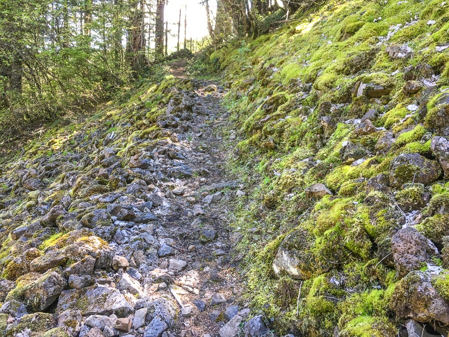
talus rock, mount defiance hike
Then, after about 3 hours of hiking, I arrived at Warren Lake, where the snow started:
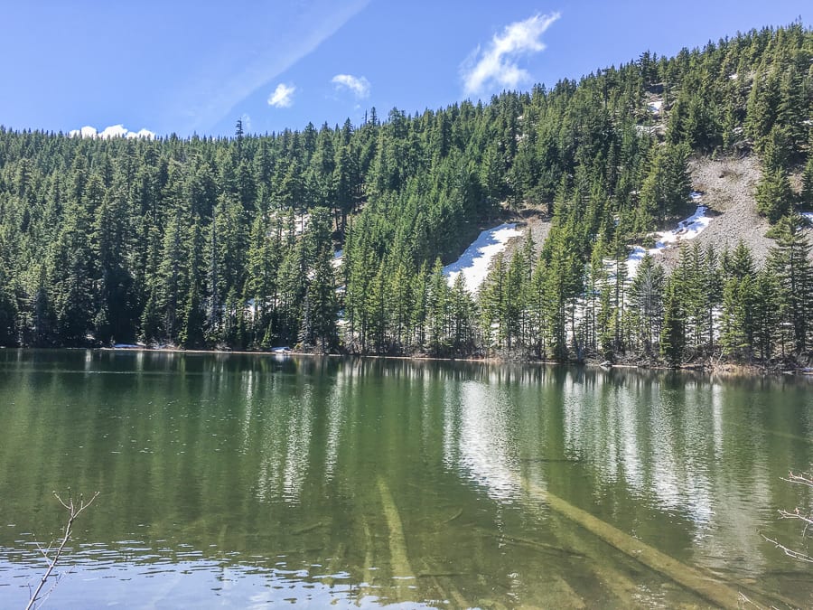
warren lake, mount defiance hike
There was SO MUCH SNOW! I hiked in mid-May and the 2 miles leading up to (and back down) the summit looked like this:
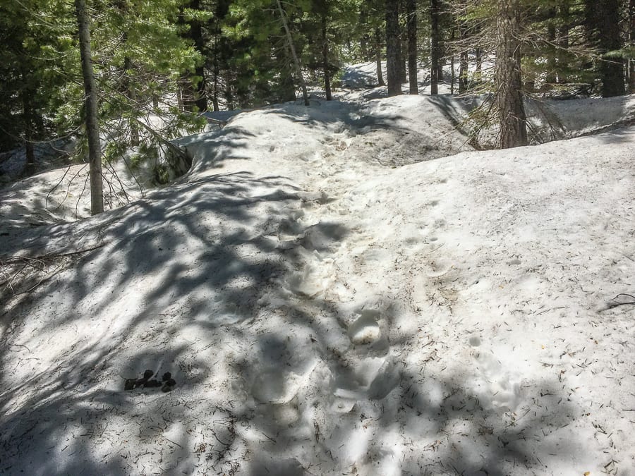
hiking in snow, mount defiance hike
The view from the top! Beautiful Mount Hood + other happy hikers taking a lunch break 🙂
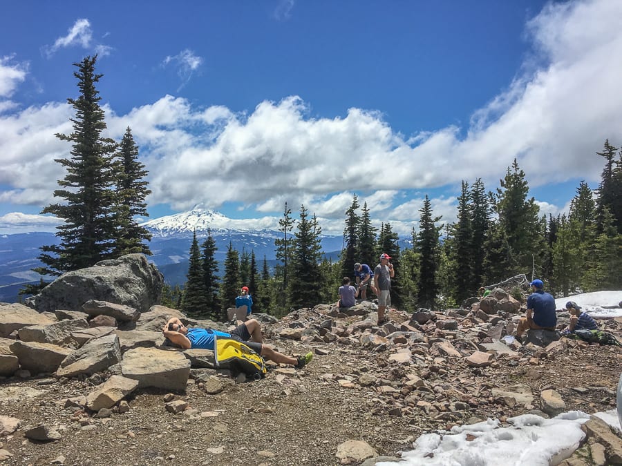
mount defiance summit, hiking mount defiance
view of mount hood, view from mount defiance hike
I started the hike at 9am and made it to the top just after 1pm, so about 4 hours up and 3 hours down + 1 hour break at the top. The views on the descent were so gorgeous and the peace and solitude I enjoyed were the icing on top of an already iced cake (and mountain)!

mount defiance hike, best hikes in oregon
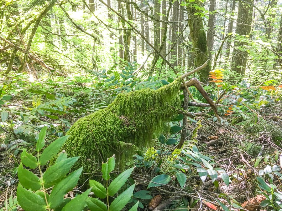
Sooooo GREEN and sooooo peaceful:
mount defiance hike, mount defiance trail
Does this look like a decrepit witch arm reaching out of the ground to you too??
mount defiance hike, mount defiance trail, witch hand
And just when I thought things couldn’t get any better, with just .5 miles left to go I was treated to two waterfalls! The 1st one, Lancaster Falls, I had to hike across, which was a bit sketch:
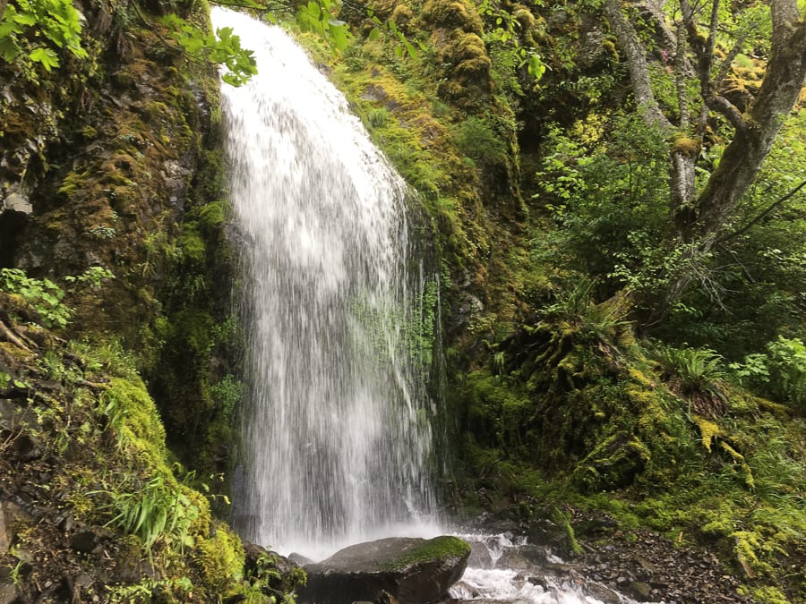
mount defiance hike, mount defiance trail, hole in the wall falls
And the 2nd one, “Hole in the Wall Falls,” had an adorable little footbridge, and basically signified the end of any and all elevation. Hooray!
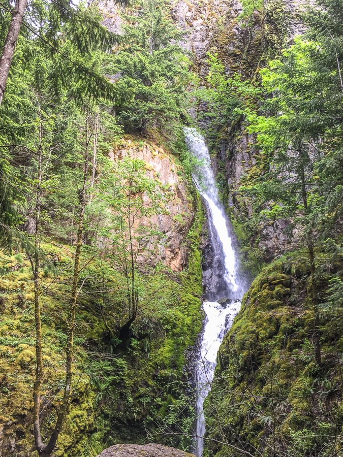
mount defiance hike, mount defiance trail, hole in the wall falls
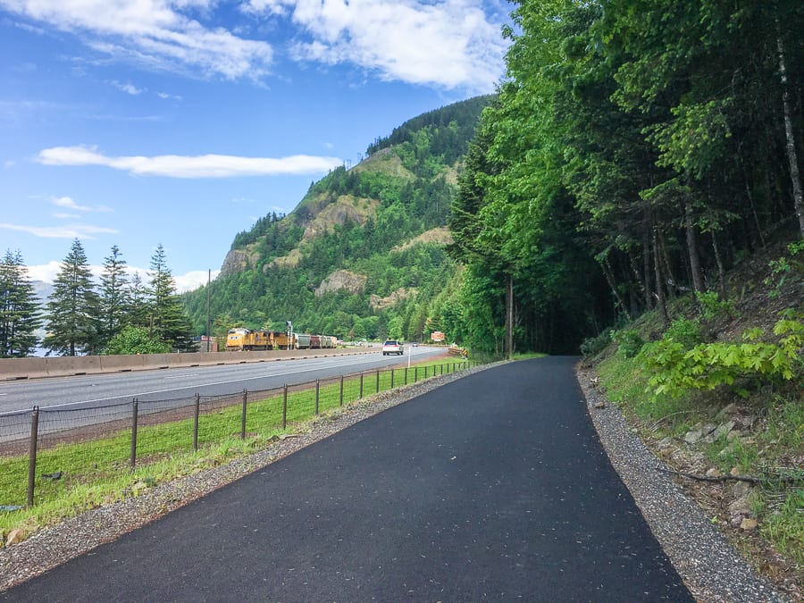
The day ended along the paved path that lead directly back to the Starvation Creek parking area where I swapped my boots for sandals and enjoyed a relaxing walk around the easy, lush trails before heading back to Hood River to enjoy sunset on The Gorge with my babe. WHAT A DAY.
mount defiance hike, mount defiance trail, starvation ridge trailhead

mosier plateau, sunset on the gorge oregon
Be sure to watch the video below for all the footage documenting my journey up Mount Defiance + a few other epic hikes!
Important Mt Defiance Info + Tips:
12.6 miles roundtrip
5,433 feet in elevation gain… nearly 1,000 feet of elevation gain per mile on the ascent
Some people take a total of 3 hours (?!), others (me) take 8
Many consider this hike Oregon’s hardest trail
Only recommended for very experienced adventurers
Mt D is a 6 million year old shield volcano
Breathtaking views of Mt Adams, Mt St Helens and Mt Hood from the top
Used as the training hike for Mt Hood and Mt St Helen’s
Some people add in 2 MORE summits, known as the “Triple D Challenge,” which is absolutely INSANE
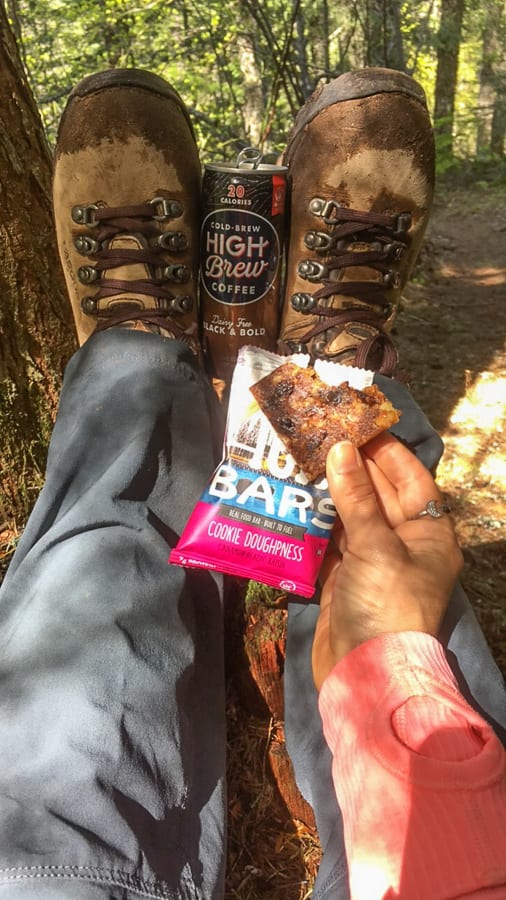
Bring at least 2 liters of water + lunch + a morning and afternoon snack (photo from snack break on a log below)
You can use poles but a lot of people don’t (I didn’t)
Wear boots (I was some people in snow shoes too)
IT’S STEEP
Expect to be nearly crippled for at least 48 hours after
It’s totally worth it.
picky bars, mount defiance snack, high brew coffee